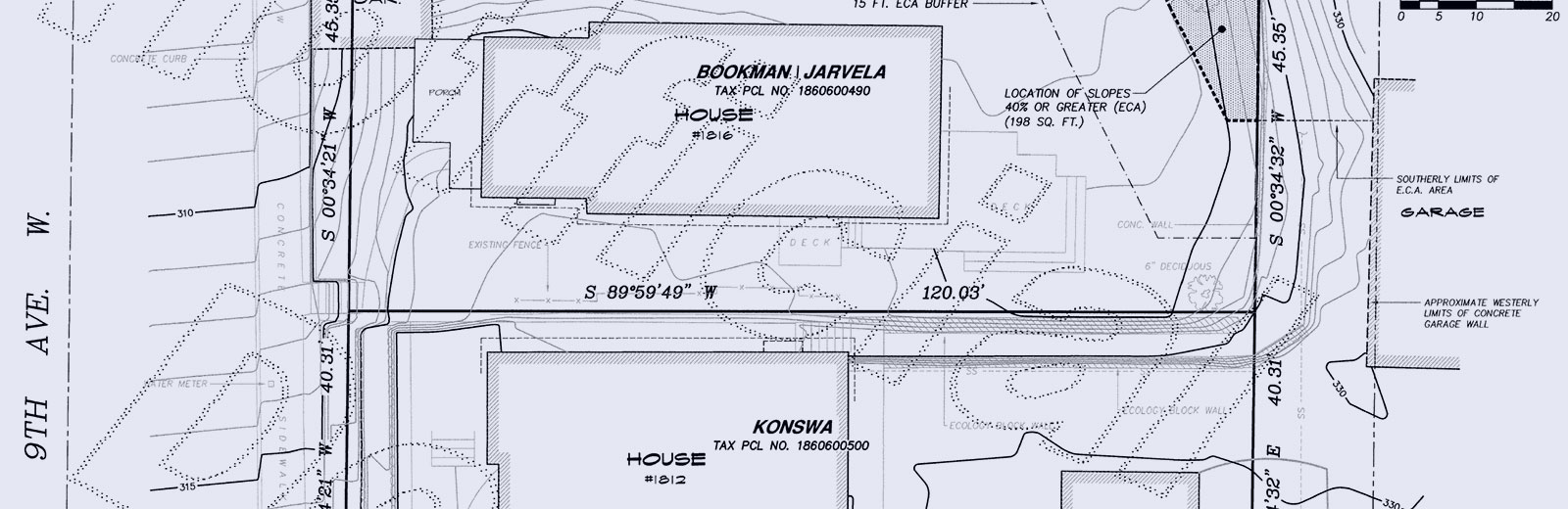
Boundary Surveys
A boundary survey physically identifies the points and locations of property corners and property lines per a property’s legal description and may also display the location of easements affecting title. A boundary survey is performed under the guidance of a professional licensed surveyor.
Our professional land surveyor calculates the boundary per the legal description and existing survey data established in the block or neighborhood where the property is located. Then our field surveyor, using state of the art equipment, maps the site and provide markers on property corners and boundary lines. Upon completion of the field work, the data is processed and assigned to a draftsman. The draftsman, using AutoCAD, completes a map/drawing of the property. If permanent monuments are set on property corners, a record of survey drawing will be recorded with the county per RCW 58.09.
Chadwick & Winters Land Surveying has provided Boundary Surveys since 1968.
Resources
app.leg.wa.gov/rcw/default.aspx?cite=58.09