Topographical Surveys
Chadwick and Winters Land Surveying provides several types of topographic surveys:
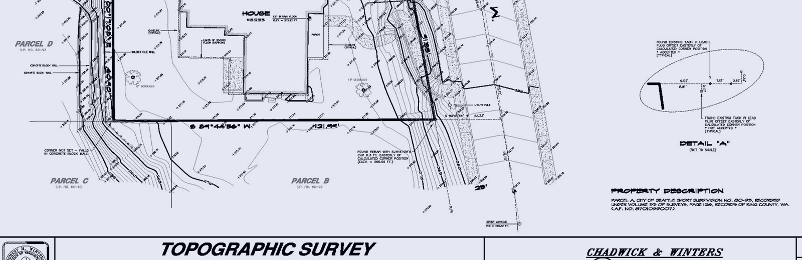
Topographic Survey
A topographic survey is usually the first step in any construction or development project. Most municipalities require a topographic survey as part of the permitting process.
A topographical survey provides 3 dimensional information about a property and illustrates the contours of the earth and the location and elevation of property features and improvements. The survey may also include the location and elevation of utilities serving the property, fronting street and alley improvements, and significant trees.
Environmentally Critical Area (ECA) Topographic Survey
If a property is located in an ECA, then additional information will be required in the survey to satisfy requirements for developing that property and obtaining a construction permit. In addition to the requirement of rigorous on-site mapping, an ECA survey is typically required to extend onto portions of adjoining properties and onto adjoining public streets and alleys. CWLS has the experience, expertise and state of the art equipment to handle the most difficult ECA sites.
SDOT or Utility Survey
When a development or construction project may impact utilities and right of ways, an SDOT or Utility Survey may be required. An SDOT or Utility Survey is required to display all fronting street and alley improvements, including overhead and underground utilities, and is typically required to extend beyond the fronting property limits and through nearby street and alley intersections. CWLS has provided numerous SDOT surveys for design and development on behalf of our clients.
Resources
www.seattle.gov/sdci/codes/codes-we-enforce-(a-z)/environmentally-critical-areas-(eca)-code